DJI Mavic, Air and Mini Drones
Friendly, Helpful & Knowledgeable Community
Join Us Now

Planning a DJI Fly "Waypoint Flight" - BEWARE! Unknown altitudes set and no warning provided.

Squidinc

I come from a land “down under”
Premium Pilot
Joined
Jun 8, 2020
Messages
1,651
Reactions
2,284
Age
66
Location
Red Head , NSW, Australia 🇦🇺
Site
youtu.be
Hi all,

I almost lost my Air 3 this week thanks to not being aware (Pilot Error) of the warning on P41 of the AIR 3 manual regarding the planing of pre-built Waypoint Flights in the DJI Fly App. The manual states...

"The flight route will curve between waypoints, so the aircraft altitude between waypoints may become lower than the altitudes of the waypoints during the flight. Make sure to avoid any obstacles below when setting a waypoint"

Seriously this is fraught with danger. You are not pre-warned of the lower altitude being implemented in the flight vs the altitude you set as a waypoint.

User beware. Suffice to say I'll never go near planning a waypoint mission again. Take a look at this...Whew!
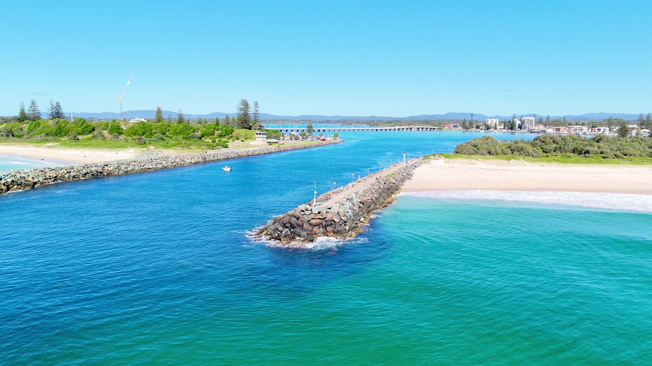
Cheers and safe flying
Squidinc
 
Last edited:
Yeah you gotta watch those closely for the first 2 or 3 flights with your finger on the pause/stop button regardless if this is a "feature" or not. I almost never trust waypoints until I get well into several tweaked rounds. Glad you caught it; close call!
 
  • Like
Reactions: RodPad and Squidinc
"The flight route will curve between waypoints, so the aircraft altitude between waypoints may become lower than the altitudes of the waypoints during the flight. Make sure to avoid any obstacles below.
Very close!

Seems an odd way for waypoints to work. I would have expected a gradual climb or decent between waypoints.

If you were climbing between waypoints why would it follow a curved path that may descend? Within reason it would be very easy to detect a decent with the barometric pressure sensor and definitely the IMU. Seems like something that could be corrected with little effort by DJI’s dev team.
 
  • Like
Reactions: RodPad and Squidinc
Dude, that's about as close as it gets!! Looked like the camera was literally skimming the water..gave me anxiety watching, even tho i already knew the result lol..
@mneeze: A pilot’s worse nightmare. Don’t let it happen to you! Add an extra 10-20 metres of altitude to every waypoint!
 
  • Like
Reactions: RodPad
Very close!

Seems an odd way for waypoints to work. I would have expected a gradual climb or decent between waypoints.

If you were climbing between waypoints why would it follow a curved path that may descend? Within reason it would be very easy to detect a decent with the barometric pressure sensor and definitely the IMU. Seems like something that could be corrected with little effort by DJI’s dev team.
@SkyeHigh You would think so, but not at the moment! Bloody frightening.
 
  • Like
Reactions: RodPad
Seriously this is fraught with danger. You are not pre-warned of the lower altitude being implemented in the flight vs the altitude you set as a waypoint.
Waypoint flights exist in 3 dimensions. You have to think in "3-D" when planning a mission. Consider the following mission:
Capture.PNG
The light blue path is how Litchi's flight path would look. The red path is how DJI Fly's flight path would look. DJI Fly uses a spline that goes through each waypoint. This red path shown above might seem completely normal when viewed from above. However, if this mission was designed in the vertical plane, you can see how the flight path can easily travel below the lowest waypoint.

Remember, think in 3-D when designing a mission.
 
Last edited:
Hi all,

I almost lost my Air 3 this week thanks to not being aware (Pilot Error) of the warning on P41 of the AIR 3 manual regarding the planing of pre-built Waypoint Flights in the DJI Fly App. The manual states...

"The flight route will curve between waypoints, so the aircraft altitude between waypoints may become lower than the altitudes of the waypoints during the flight. Make sure to avoid any obstacles below when setting a waypoint"

Seriously this is fraught with danger. You are not pre-warned of the lower altitude being implemented in the flight vs the altitude you set as a waypoint.

User beware. Suffice to say I'll never go near planning a waypoint mission again. Take a look at this...Whew!


Cheers and safe flying
Squidinc
Wow that was close!!
 
@DJ Wes Thank you for your detailed explanation.

Couldn’t this all be rectified in DJI Fly by providing what actual altitude the flight between waypoints will be implemented when a waypoint altitude is input or changed? You could then make the necessary input to fly the mission safely.

Currently it gives meaning to that old cliche “Wing and a prayer”🙏
 
I am glad you managed to save your drone. Thanks for sharing
 
Couldn’t this all be rectified in DJI Fly by providing what actual altitude the flight between waypoints will be implemented when a waypoint altitude is input or changed? You could then make the necessary input to fly the mission safely.
Of course, they could. Since the waypoints are uploaded to the drone, the path is also calculated on the drone. However, the path preview is also shown in DJI Fly. Therefore, it would be possible for them to display the minimum and maximum heights that the path will take.
 
  • Like
Reactions: Squidinc and RodPad
Yikes! That was way too close for comfort! Thanks for raising my awareness on this issue, as I’m relatively new to my Air 3 and haven’t yet tried setting up a waypoint mission.
 
  • Like
Reactions: Squidinc
Yikes! That was way too close for comfort! Thanks for raising my awareness on this issue, as I’m relatively new to my Air 3 and haven’t yet tried setting up a waypoint mission.
@PMF23 You’re welcome. As I mentioned earlier in this thread, I would add 10-20 metres to every waypoint (particularly where the flight curves).

Then cautiously fly the mission with your finger hovering over the left RTH button on the RC2 controller, and your eyes glued to the screen! Ready to abort at any second.

Personally, this taken the fun out of flying a preplanned flight for me. To risky. I won’t be using this feature until such time that DJI write a fix that warns you of the actual altitudes between waypoints that the flight will take.
 
Waypoint flights exist in 3 dimensions. You have to think in "3-D" when planning a mission. Consider the following mission:
View attachment 174562
The light blue path is how Litchi's flight path would look. The red path is how DJI Fly's flight path would look. DJI Fly uses a spline that goes through each waypoint. This red path shown above might seem completely normal when viewed from above. However, if this mission was designed in the vertical plane, you can see how the flight path can easily travel below the lowest waypoint.

Remember, think in 3-D when designing a mission.
This is good info. You also have to be careful in the horizontal plane if, for example, waypoints 2 and 3 were close to a cliff face or building. The spline curve could cross into something solid. I wonder how obstacle avoidance would handle this?
 
Does collision avoidance not work on waypoint mission ? few days ago I had Litchi fly my Air2s into the ground (saved by the dense grass, no damage, thankfully), while trying out Litchi waypoints.
I had low altitudes programmed (2-3m), but assumed the collision avoidance will abort mission ? seems not to be the case
 
  • Like
Reactions: guzewski
Wait a moment if at all waypoints the AGL is set to 20 meters will the path between each waypoint remain at 20 meters? Unless then you set one waypoint to 2 meters AGL (never) then the drone will decent gradually to that level?

Help me understand this. TY
 
Sounds like OA was off, as it likely had to be to even be able to fly that low without getting stopped constantly.
OK but

1. To be clear if both waypoints are at 20 meters the drone will not dip down between the two waypoints?

2. Did I read somewhere that OA is not to be trusted over water?

Thanks all,
 
Sounds like OA was off, as it likely had to be to even be able to fly that low without getting stopped constantly
I wanted to have a repeatable flight down the driveway. Sort of cinematic "camera dolly". I flew it by hand many times, 2 m is high enough not to trigger OA.
 

DJI Drone Deals

New Threads

Forum statistics

Threads
131,274
Messages
1,561,520
Members
160,226
Latest member
RWShepard